
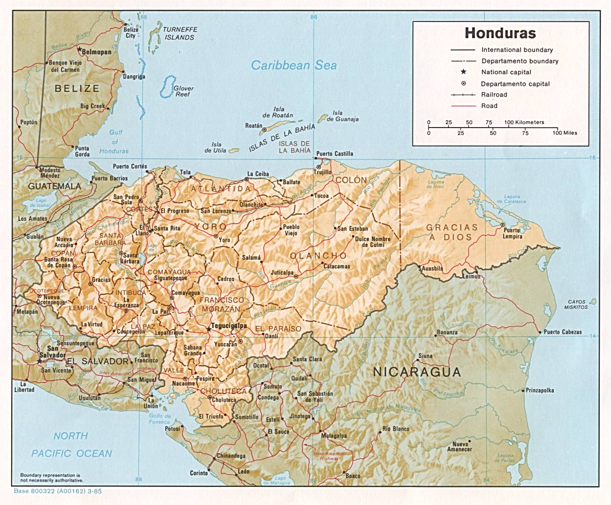
 Topographical map of Honduras
I have always loved maps! Whenever I've gone on a road trip in the U.S., I spend hours and hours following along on the road map, looking up the "sites of interest." Geography was one of my favorite classes. I'm not sure if it is even taught anymore. Every time I open an atlas, I just get lost in time.
There aren't a lot of good updated maps of Honduras. We had a large map which had some handy street maps of the larger cities. Someone stole it out of our car! I was able to find these maps on the internet which I thought might be of interest to you.
Most of these are from (of all places) the University of Texas Library. The site indicates that these are in the public domain so it is okay for me to use them and okay for you to copy them if you wish. You might get a better copy if you go the link below each map though.
You can see that most of Honduras is mountainous. The large flat area to the east called Gracias a Dios is primarily swamps or wetlands and is only sparsely inhabited. It includes the area variously called La Moskitia for the native Miskito indians, La Mosquitia in Spanish, or the Mosquito Coast in English that was the setting of the Harrison Ford movie by the same name.
The CIA Factbook states that Honduras contains 112,090 sq. km. (43,278 sq. mi.), about the size of Tennessee. The major roads are marked in red on the above map. You can see that there aren't many.
You will probably have to click these maps and enlarge them to be able to read them.

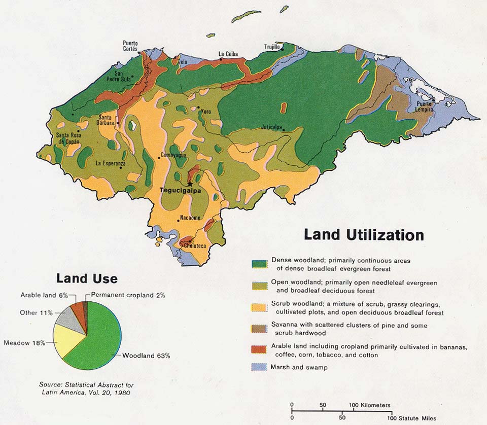
Amazing that only 6% of the land is considered arable. Much of the country is covered with mountains.

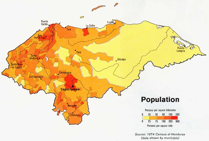
Population estimates vary widely but just to give you an idea, the capital city of Tegucigalpa has an estimated population of about 1.5 million, the industrial capital San Pedro Sula about 1 million, and La Ceiba, the third largest city, about 250,000 including the surrounding aldeas (villages).

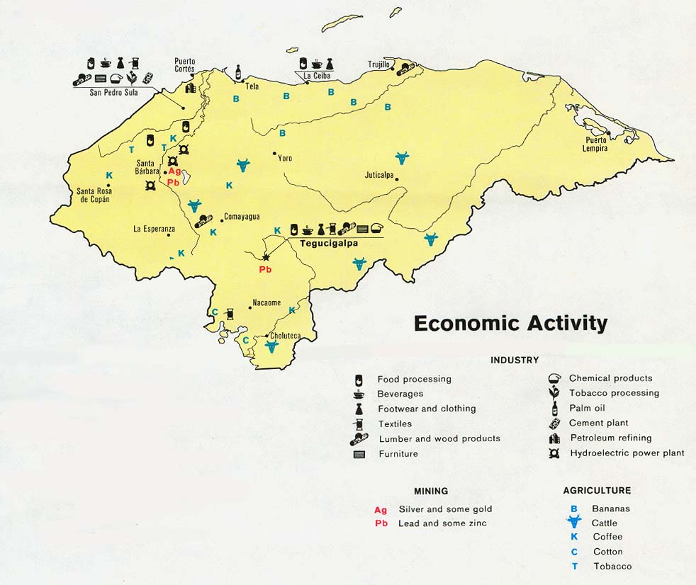
This is very old data (1983) but ....
There are many more maquillas (factories) now than there were in the 1980's, especially in and around San Pedro Sula, El Progresso, Puerto Cortes, and other areas.

This is one of the only Honduran government issued map that I could locate. Honduras is divided into 18 departamentos (states). The yellow one at the top is Atlantida and that's were La Gringa lives.


 Welcome to my Blogicito —


